
FAQs
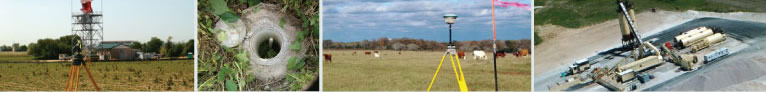
WHAT IS A LAND SURVEY?
A land survey is a measurement of real property showing the locations of boundaries and existing features of a property within the guidelines of state laws and professional organizations and prepared under the direct supervision of a registered or licensed surveyor for that state.
WHO CAN LEGALLY PERFORM SURVEYS?
A land survey can only be certified by a professional land surveyor who is licensed to practice in the state where the property is located.
WHY WOULD I NEED A SURVEY?
There are a wide variety of reasons to obtain a survey. Following are several instances that you would need a survey:
1. Buying or Selling Property - You need a survey when you buy, sell, or refinance your property. A current survey will help the sellers or buyers and the title companies determine any encroachment problems with the property.
2. Division of Property - You would need a survey to divide property between individuals such as when a family member dies and leaves their property to all the children, or when you would like to sell a part of your property to someone else. This category could also apply to Land Development, when a large tract is purchased and then divided into smaller tracts to be sold.
3. Improvements or Construction - It is wise to have a survey done when you are constructing fences or walls along your property line, or planting or removing trees along property lines to ensure that you are working within the boundary of your property. A survey may also be necessary to obtain a building permit for any construction you wish to do on your property.
4. Land Development - When planning for improvements you would need to get boundary, tree and topographic surveys prepared for use by an engineer and an architect to develop your property. Once the engineer and architect have finalized plans for construction, then there would be a need for construction layout or survey. After construction, you would then need a final or as-built survey prepared.
5. Dedicating, Modifying or Removing Easements - You may need a survey if you want to create, change, or remove an easement from your property.
6. Boundary Dispute or Encroachment - You would need a survey to determine whether or not you or your neighbor may be encroaching or if there is a disagreement upon where the property boundaries exist. If there is an encroachment or dispute, legal counsel or an attorney is recommended to work through any legal resolutions.
ARE THERE DIFFERENT KINDS OF SURVEYS?
Yes, there are several different kinds of surveys. The following are the three main types of survey:
1. Land Title Surveys are required when you buy or sell a property. In the last few years, using an old survey has been allowed in these transactions. While this will decrease the closing costs, the old survey may not represent the conditions actually on the ground currently. A current survey will address any changes that may have occurred, including any new improvements on the property or any new easements created since the previous survey.
2. Boundary Surveys are very much like a Land Title Survey. This type of survey is usually ordered by the land owner for a variety of reasons: to have their corner markers found or set so that the owner is certain exactly where his or her property is located; to have additional markers set along a property line for fence or other improvement construction; to locate any new improvements placed on the property since the prior survey; or, to help resolve any boundary line conflicts with neighbors.
3. Tree Location and Topographic Surveys are used when preparing for constructing a house on a previously vacant lot. A tree and topographic survey may be needed for your engineer or architect to help them design your new home. This survey will show the trees, and their sizes, define the contours (elevations) drainage patterns, etc., that exist on your property.
WHAT SHOULD I EXPECT WHEN HIRING A SURVEYOR?
You should expect the surveyor to ask you very specific questions about why you need a survey to determine exactly what kind of service you need from the surveyor. You should request a written agreement or contract defining the services to be performed, the fee you will be required to pay, and the length of time it will take to complete.
HOW MUCH WILL A SURVEY COST?
The fee for a survey will depend on several things: the size, location, and accessibility of the property; the amount of elevation change across the tract; whether the tract has been cleared or is covered with brush; and the amount and availability of information and deed research necessary to determine the true boundary of the tract, availability of survey monumentation, boundary occupation problems or disputed areas, the complexity of the boundary or improvements on the property, type of survey requested, among other possible issues.
Based on your answers or the surveyor's visit to your property, the surveyor will be able to determine the fee, which could be several hundred dollars or several thousand dollars.
HOW LONG DOES IT TAKE TO GET A SURVEY?
Land Surveying is a very in-depth process that may take several hours or several weeks depending upon the complexity of the project, property conditions, or research needed. It is best to contact a surveyor to set up a survey as soon as possible in order to be sure to have the survey completed when you will need it.
In rare cases, some surveyors may have an opening in their schedule and may be able to get to your property within a few days notice. In most companies, that is not the case, so if you are purchasing a property, it is best to contact a surveyor, no less than a month before closing, to insure that it will be completed in time for your closing date.
WHY AM I PAYING SALES TAX ON A SURVEY?
The Texas Comptroller's Office has determined that surveying is a real property service and, as such, is a taxable item. We must charge sales tax on activities performed to determine or confirm the boundaries of real property, or to determine the location of buildings or other improvements in relation to the boundary of your property.
WHY DID THE SURVEYOR GO OVER THE ENTIRE BLOCK TO SURVEY MY NEIGHBORS' PROPERTY?
To prepare a reliable survey, the surveyor must examine all descriptions of record (deeds, plats, etc.) for the block or the immediate vicinity. He should try to find and locate all the property corners that are called for in those documents. This is the only way a surveyor can find any discrepancies or errors in prior surveys or deeds that might adversely affect your boundary line location.
By doing the necessary research and field search, the surveyor can more accurately determine to actual location of his client's property.
I ONLY NEED ONE OR TWO MONUMENTS SET. WHY DO YOU NEED TO SURVEY MY WHOLE PROPERTY?
When a lot or parcel of land is surveyed, the surveyor is liable for any accepted evidence or monuments. At a minimum, the surveyor will need to perform enough survey work to be certain that all the monuments accepted reflect the true location of your boundary. Therefore, in order to be certain that the monuments are in the correct locations, a full boundary analysis of your property is required.